Local Weather Conditions
Is the flying good to go tandem paragliding or hang gliding?
The top graph is temperature and dew point temperature. The lower graph is wind speed and direction. Flying at the Gliderport is best when winds are from the Southwest to Northwest at 8mph and above.
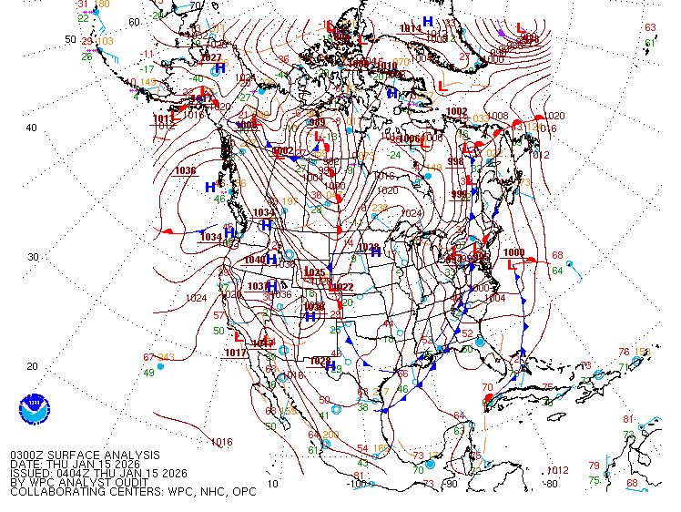
Continental US (CONUS) Pressure Maps

The pressure map is important. Flying in Southern California, is best in a low pressure system. When lows are located east of La Jolla, and highs are located off shore to the west, we can generally guarantee good flying with nice onshore winds.
The Skew-T or Sounding

The skew-t or sounding is provided based on data collected from weather balloon releases every morning and afternoon. These models show us what the upper winds (winds aloft) are doing. They also provide indication of thermal strength, cloud base, general cloud coverage, maximum temperature for the day and for cross country pilots an indication of what altitudes contain the strongest lift.
National Weather Service Radar

This RADAR snapshot show incoming weather fronts. Low pressure systems coming on-shore are usually preceded by excellent flying days. Pilots call this “pre-frontal conditions.” When you hear that, bring your wing ’cause it is ON!